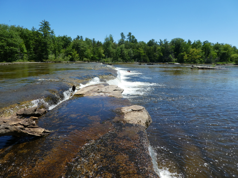
Callaghan’s Rapids Conservation Area features two waterfalls which are about one metre in height which both span the entire width of the Crowe river, which is about forty to sixty metres across. When river flows are low enough, you can walk out and explore the river bed. The upper waterfall is interesting in that it is formed on a wedge-shaped outcrop of limestone which appears to be beveled down to a sharp edge, right at the crest of the falls. The lower falls is similar, but does not exhibit the beveled-edge crest.
2guyswalking website has a great article (posted 2016) with trail map and images. Go here to read this article.
Callaghan’s Rapids Conservation Area is just one of the many nature trails and hiking trails you can find throughout Ontario by using the search features of OntarioNaturetrails.com
Region(s): Hastings CountyNearby towns and cities: Marmora
Trail feature tags: Waterfall
Callaghan’s Rapids Conservation Area characteristics
Length: Not knownDifficulty: Moderate (Trail classifications)
Trail surface: Natural
Trail use: Hiking
Accessibility Notes: Not wheelchair accessible.
Fees: None reported
Flora & Fauna:
Not reported yet
Amenities: None
Attractions: Waterfalls
Contact:
info@crowevalley.com
Crowe Valley Conservation Authority Marmora, Ontario Phone: 613-472-3137
Find it: On Highway 7, between Havelock and Marmora, turn south on Tiffen Road. Follow to the end and then turn east on Callaghan Rapids Road. Follow to the end.

GPS Coordinates (main trailhead):
Latitude: 44.4451030
Longitude: -77.6939000

This is an unmarked trail, heavily used by ATV’s. Only a 5 minute walk from parking lot.