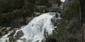
Known as “the best waterfalls in the area” is the most visited, anytime of year! One of three waterfalls that surround the City of Owen Sound, Inglis Falls is the best known and most visited. Situated in the heart of the 200-hectare Inglis Falls Conservation Area, Inglis Falls is an 18 metre high cascade, created by the Sydenham River meeting the edge of the Niagara Escarpment. The erosive power of the water has carved a deep gorge at the base of the falls. On a clear day you can see down the valley into the City of Owen Sound and out to the Owen Sound harbour.
There is something for everybody; a viewing platform for those unable to see over the stone wall, 7.42 km of trails of various difficulty, access to the Bruce Trail, more than 20 species of ferns, bird watching opportunities, a series of geological potholes, historical remains of a grist mill, washrooms, picnic facilities and visitor information centre.
Link to trail map: http://www.greysauble.on.ca/portfolio/inglis-falls-conservation-area/
We would also direct you to read our DISCLAIMER and our TRAIL USERS CODE.
Region(s): Grey County
Nearby towns and cities: Owen Sound
Trail feature tags: Lookout | Waterfall
INGLIS FALLS TRAILS characteristics
Length: 7.4 kmDifficulty: Moderate (Trail classifications)
Trail surface: Compacted soil/hard packed
Trail use: Hiking, Cross-country skiing, and Snowshoeing
Accessibility Notes: scenic lookout
Fees: Parking fees
Flora & Fauna:
Not reported yet.
Amenities: picnic areas, washrooms, potable water.
Attractions: Waterfalls, Scenic Lookout
Contact:
Grey Sauble Conservation Authority 519-376-3076

GPS Coordinates (main trailhead):
Latitude: 44.5256900
Longitude: -80.9357000
INGLIS FALLS TRAILS Image Gallery
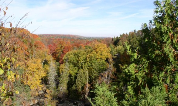

Photo credits:
Don Knight, Grey Sauble Conservation.