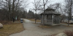
The Georgian Trail begins/ends in the east at Collingwood’s Harbourview Park and near Meaford Harbour in the west and runs along the beautiful south shore of Georgian Bay.
From Craigleth to Meaford, the trail runs near Hwy. 26 West with numerous access points along the way including: Northwinds Beach, Craigleith Prov. Park (Day-pass required), Council and Peasmarsh Beach, The village of Thornbury, Thornbury Harbour, Bayview Park and Meaford Harbour. There is parking at Harbourview Park in Collingwood and from there, the trail heads west towards Craigleith and on to Meaford.
About 3-4 km from Meaford there is a 1 km trail (St. Vincent Trail) that leads north from the Georgian Trail to a spectacular Georgian Bay lookout on the brow of what is known locally as the clay banks. This short trail is natural and twists through a conifer plantation.
Link to trail map: https://maps.simcoe.ca/trails/?TRAIL=GeorgianTrail
We would also direct you to read our DISCLAIMER and our TRAIL USERS CODE.
Region(s): Grey County | Simcoe CountyNearby towns and cities: Collingwood | Meaford | Thornbury
Trail feature tags: Viewing Platform
GEORGIAN TRAIL characteristics
Length: 34 km.Difficulty: Moderate (Trail classifications)
Trail surface: Compacted soil/hard packed and Natural
Trail use: Hiking, Cross-country skiing, Snowshoeing, Mountain biking, Cycling, Geocaching, and Winter (Fat) Biking
Accessibility Notes: Wheelchair accessible.
Fees: No fees
Flora & Fauna:
Not yet reported.
Amenities: None reported.
Contact:
info@georgiantrail.ca

GPS Coordinates (main trailhead):
Latitude: 44.6072600
Longitude: -80.5886200

This is a great trail for walking and cycling.
Good trail to see flowers in bloom in the spring.